Local History Talk presented at Tin Can Bay Library – Thursday 10 November 2022
Today, we are incredibly lucky to be meeting here to look at the history of the area and the anniversary of the first land sale in this area 100 years ago today. The town was originally called Wallu but was changed to Tin Can Bay in 1937.
Interestingly however, old newspapers and reports were already using the name Tin Can Bay.

The origins of “Tin Can” are uncertain, however it is believed to be derived from an indigenous name, possibly tinchin meaning mangrove in the Yugarabul dialect of the Yuggera language, or tinken meaning vine with large, ribbed leaves from the Doombarah Clan, Dulinbara dialect of the Kabi language.
Zachariah Skyring, who wandered the area with the local indigenous tribe, said the aboriginal word for this area was TUNCUNBA. BA means ‘place of’ and TUNCUN means ‘plenty’ – hence a place of plenty. This reference to a “place of plenty” can be found in later newspaper articles however the translation has not been confirmed.
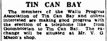
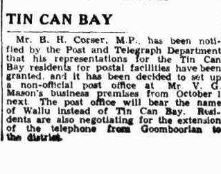
In 1934 when Mr. B. H. Corser. M.P., was notified by the Post and Telegraph Department that his representations for the Tin Can Bay residents to have postal facilities had been granted and that it had been decided to set up a non-official post office at Mr. V. G. Masons business premises, they were told that the post office would bear the name of Wallu instead of Tin Can Bay.
4 September 1934 pg2

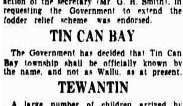
However, on 6th March 1937 the Courier Mail published a small article which read “The Government has decided that Tin Can Bay township shall be officially known by the name, and not as Wallu as at present.” And just like that the deed was done.
Of course, there are always a few that disagree as the Brisbane Telegraph noted in 1948 that residents of Tin Can Bay “do not like the name. They think it suggests untidiness instead of an attractive seaside resort, and a move is afoot to change the name to Bradman Bay. Years ago, the locality was known as Wallu, and no one knows why it was altered to Tin Can Bay. A previous attempt was made to scrap this name in favour of Cooloolaba, but the Government wouldn’t agree to this change.” And in a follow up article “someone at the Lands Department has disclosed that the name Wallu was changed to Tin Can Bay in 1937 at the request of the Sports and Progress Association.” An old resident says that the original native name for the place was Tunkun (home of the dugong) and that this gradually became Anglicized to Tin Can.
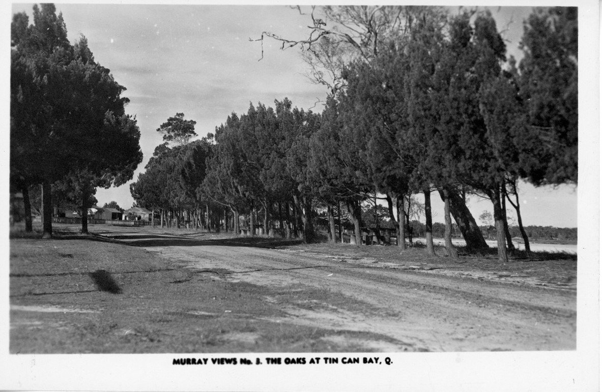
European settlement began in the area in the 1870s. Poverty Point was the location of one of the state’s earliest railways. This was constructed to transport logs to the shoreline, from whence they were relayed, via raft, to the mills of Maryborough. Newspapers at the time would publish articles outlining the activities. One such article from 1936 states “Timber getters are at present hauling huge lronbark and various kinds of gum and red stringy bark logs, from the Tin Can Bay district scrubs to the rafting grounds, where they will be taken by raft towed by motorboats to the Maryborough district sawmills”
In 1863 Mr William Sim went into partnership with Mr W Pettigrew, a timber pioneer in establishing the largest timber mill in Queensland, at the time Dundathu. The logging areas for the new Dundathu mill east of Maryborough, encompassed large tracts of land around where the tiny settlements of Boonooroo, Poona, Tinnanbar and Tin Can Bay now stand. Business prospered up to the early 1870’s establishing a profitable timber trade with Sydney and North Queensland. During this period a locomotive was purchased to haul the logs to the Mill, and steamers for the timber further away from the mill. In fact, some long-term residents may still remember seeing the wreck of the Hercules at the mouth of Tinana Creek. Unfortunately, William Sim was killed by a log falling on him at the rafting grounds of Tin Can Bay in 1873. His elder sons William and James carried on the mill with Mr Pettigrew until 1893.
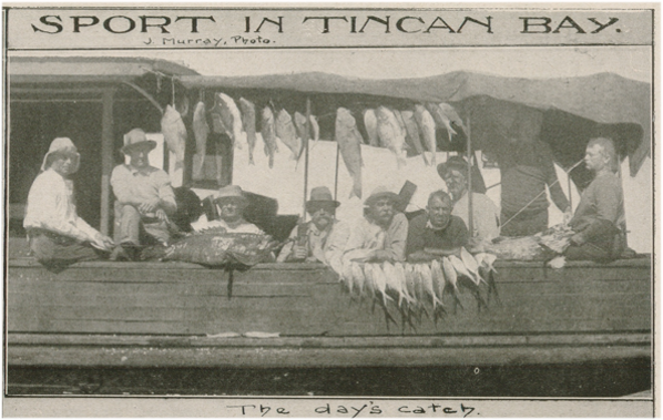
The protected shallows of the inlet were ideal for exploitation. Dugongs were hunted for their oil, and a dugong station was set up at the mouth of Kauri Creek (eight km north of the inlet) in the 1850s. Timber was drafted out for Maryborough sawmills, and oysters were cultivated and harvested at the mouth of Snapper Creek, the waterway running through Tin Can Bay Township. Les Lee a long-time resident recalled that at one stage there were 317 oyster beds in Tin Can stretching from the head of the bay up to Fig Tree with hardly a break. Vera Mallet recalled “Every day we feasted on fish, crabs and oysters. We never tired of the lovely bream, whiting and cod that Dad would catch just down at Skyring Rocks (as it was called in those days) Years later Viv Mason built a jetty near them, and they became known as Mason’s Rocks…and the crabs! I haven’t seen crabs as big or as full as those that Dad caught just down outside the mangrove roots. What beauties. Big and Fat and clean, the flavour was out of this world! No pollution anywhere in those days.”
Mr Les Armitage made his first trip to the bay in 1911 with his father, Henry, who was a bullock driver. “There were no houses here then just a few humpies” he recalled. “There also were fisherman’s camps. They were doing a fair bit of dugong fishing and had camps at Teebar Creek, Kauri Creek and Poona. Then there were Boonooroo fishermen. They used to work in Tin Can Bay long before there were any Tin Can Bay fishermen. They used to come up here and get fish for smoking. From Kauri they used to put them on a packhorse and send them up through Bauple. Up at Kogle Point at the head of the bay was one of the main timber rafting grounds.”
The first recorded inhabitant to settle in the Tin Can Bay area was Mr R W Leftwick who settled at Snapper Creek in the early 1890’s and established an oyster farm. Oysters were cultivated and shipped to the southern markets from Inskip Point. Despite initial hopes the venture was not commercially successful owing to the variable tides. The Leftwick family however remained on in the area and their daughter was one of the first children born in the new settlement. [Read about Snapper Creek vs Schnapper Creek]
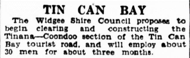
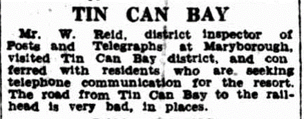
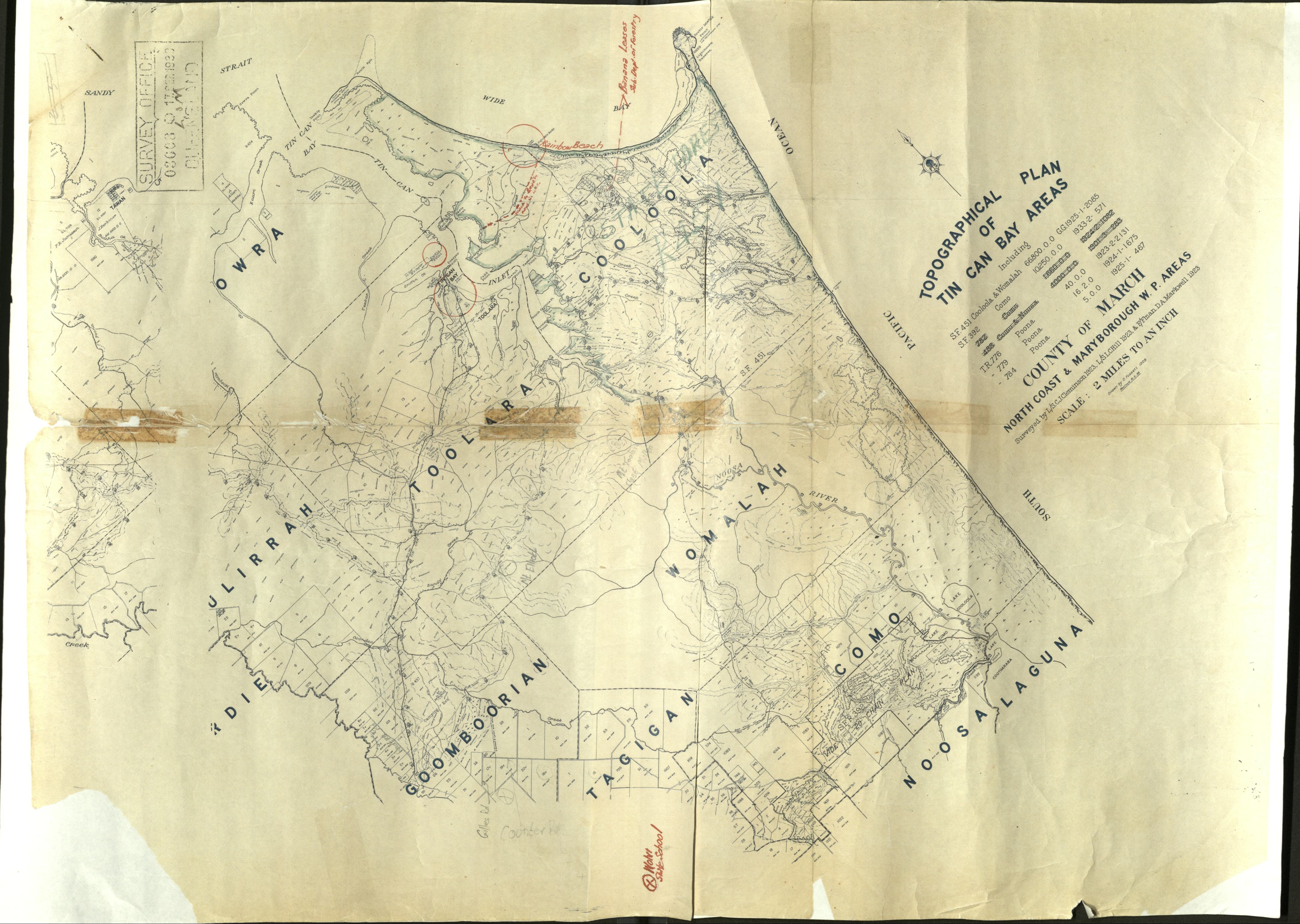
By the turn of the century, Tin Can Bay still had no permanent settlement with only a few humpies built at Schnapper Creek. A telegraph line from Tiaro to Inskip Point and the Double Island lighthouse was established, and awareness of the area grew. Mr and Mrs J Bonney established a guest house on the Cooloola Creek in 1904 catering for timber cutters and travellers. The move to open up the area coincided with a basket picnic held on the banks of Coondoo Creek on July 22, 1917, when a group described as motoring enthusiasts decided to establish working parties of volunteers to bridge the many creeks along the route of the proposed road to Toolara. Old records show that none of the blocks were sold at the first auction on August 20, 1918. They were re offered, together with the first 25 blocks in the township of Wallu at a subsequent auction held on November 10, 1922, some one hundred years ago.
Of the 25 town lots seventeen were sold at prices ranging from 8 to 36 pounds. The average size of the blocks were about two roods. Six suburban lots with areas of about 3 acres each realised from 4 pounds 10 to 9 pounds. It may interest you to know that a rood and a perch are the names given to subdivisions of an acre. There are four roods in an acre, and in turn a rood contains 40 perches. As a rood is a quarter of an acre, it contains 1.012 square metres – about the size of two tennis courts. Each of the 40 perches in a rood thus consists of just over 25 square metres – the size of one of the net-side playing areas of the tennis court.
This is why on a land survey map that gives the dimensions of each parcel’s area of land, you will never find more than the quantity of 3 roods or 39 perches noted – which is helpful to know if the numbers are hard to decipher. As a further example, if a landholder owned 4 acres and 3 roods, and then bought a further rood, he (or she) would then own 5 acres in total. Similarly, should the owner have 4 acres 3 roods and 39 perches, only one extra perch would be required to make up the 5-acre block, as the extra perch would give a total of 40 perches (a rood), which in turn would make a total of 4 roods (an acre) to add to the 4 acres.
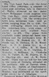
The areas were available under perpetual lease conditions and the very first purchasers of land at Tin Can Bay one hundred year ago were M. E. Pearce, W. Bushell, T.H. Steele, B. Dickson, D.D. Woodrow, A.G.D. Austin, A.J. McFie, F.J. Gillis, R.M. Hose, Mabel C. Power, S.F Sheldon, D. Molki , A. Williams, A. Chisholm, B. Power, L.M. Pearce, Z.D.S. Skyring, C. Meyers, V. E. Walker, D.J. Groundwater, C. Gidley, N. O’Brian, A.P. McKenna and J.W. Burkhardt. There was no bid for ten lots in the town of Toolara, situated on the northern side of the Teewah Creek.
The Daily Mail in February of 1923 was quoted as stating, “It is evident that with the improvement of the road from Gympie to Tin Can Bay that seaside resort will soon become a favourite with Gympieites seeking a pleasant weekend. A party of railway locomotive men from Gympie numbering 19 made the journey to the bay last Saturday by motor bus and car, returning in time for tea Sunday evening. Piloted by their manager, Mr. George Day, and with the outing enlivened by the musical and humorous entertaining qualities of members of the party, a really enjoyable time was spent. A dip or two in the salt water and delicious feeds of oysters and crabs, for which Tin Can is famous, put the whole party in the best humour to enjoy a really delightful trip.”
However, by 1929 Tin Can Bay still only had three permanent residents as the majority of the lots were bought by residents of Gympie and Widgee Shires for holiday houses.
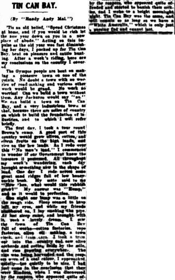
A gentleman by the name of Andy Mal wrote into the Maryborough Chronical “Tis an old belief, ‘Spend Christmas at home, and if you would be rich let the new year down on you in a new place of abode.’ Acting on this impulse as the old year was fast diminishing her day, I packed up for Tin Can Bay, bent on pleasure and cattle hunting. After a week’s riding, here are my conclusions on the country I covered. The Gympie people are bent on making a pleasure town on the point. No doubt a town with no worries of road making and various other work would be grand. No work no worries! Can we build a town without them. We can build a town on Tin Can Bay and a very industrious town at that, because there are miles of country on which to build the foundation of the industries and to which I will refer briefly. … A good part of this country would grow olives, cotton and fruits as the high lands and rice on the low lands…I commenced to wonder if our Government knew the treasure it possessed. All throughout my weeks wondering each day brought something new in the shape of the land. One day I rode across some great sand ridges full of low honey suckle bush. My mate said to me now then what would this rubbish grow? My answer was Hemp and so it would to perfection. … Sleep seemed to have left my eyes and while my friends slumbered on I lay smoking the pipe. At last sleep came and brought with it such a lovely dream. I saw the town of Tin Can. Full of workers – cotton factories, rope factories, olive oil making, a town clock and tram cars.”
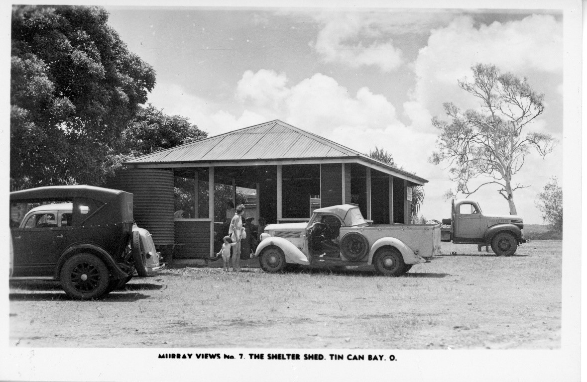
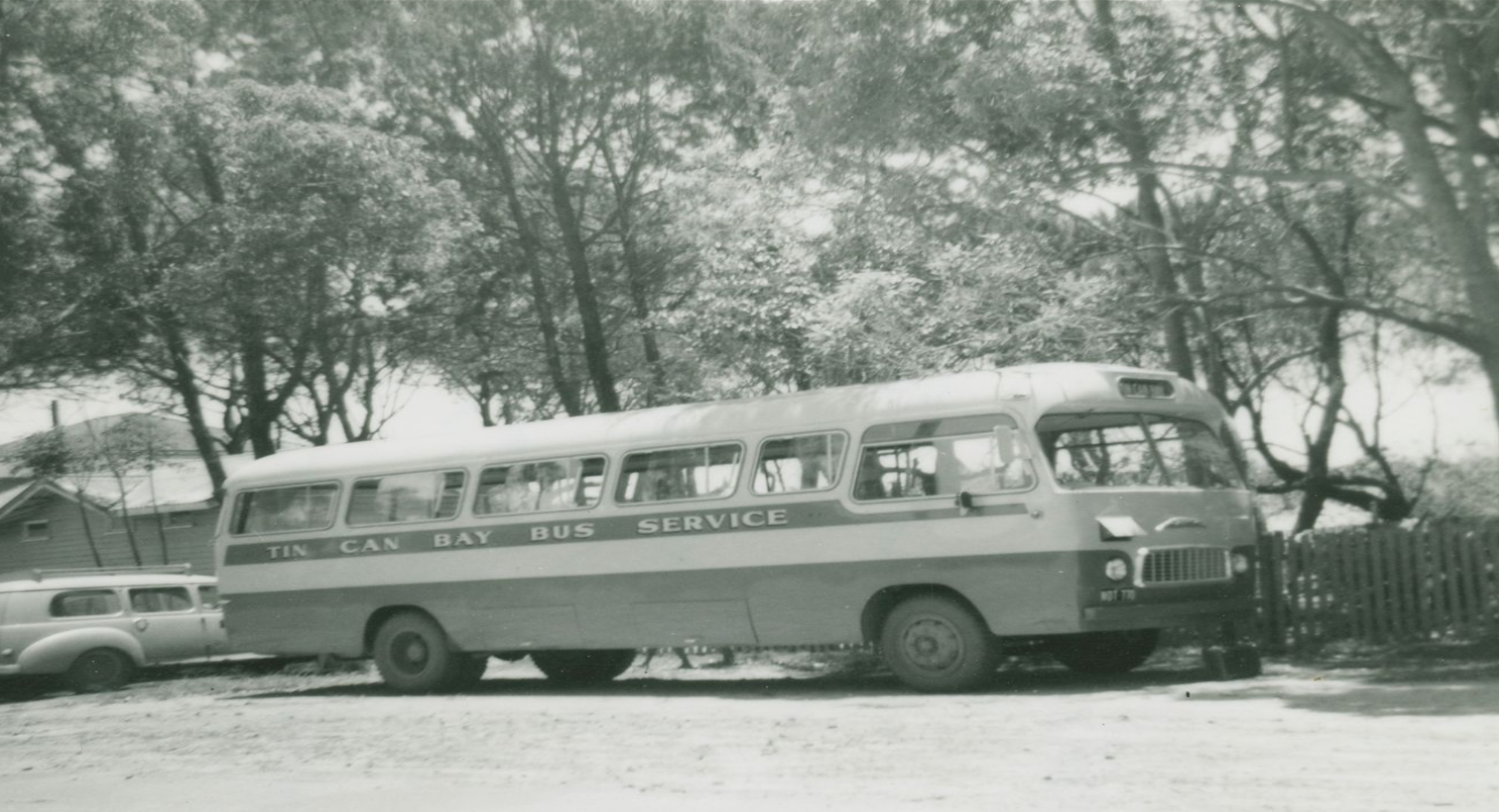
In the 1930s, the cheap land and plentiful fishing attracted the much-awaited permanent residents, many of whom were affected by the Economic Depression. This was aided by a government construction program to build a new permanent road from Gympie to Tin Can Bay. The first shop in Tin Can Bay was built in 1932 by Viv Mason, on the corner of Jew Street and Tin Can Bay Road. Viv sold everything to the growing population from hooks to hams, from papers to potatoes and his shop was the focal point of the community. At this time the town had 35 permanent residents.

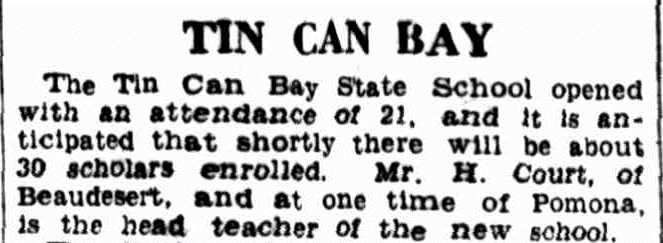
In 1933 the lands department gazetted 1 acre 3 roods and 24 perches of land at Tin Can Bay as a school reserve. With Mr Woods of Chatsworth erecting a state school building on the site. The school was opened in 1934 and the original school building was removed from the old Wolvi State School and thus Wallu State School was ready for its intake of 28 students at the commencement of 1934. The 28 children that “were running wild and receiving practically no education whatsoever” had formal schooling with the late H.C. Court as the Headteacher. The one-room school building quickly became overcrowded, and an additional room was required. In May 1937, the existing school building from Bells Bridge was re-erected at Tin Can Bay.
The Queensland Fish Board Tin Can Bay market opened in 1945 and by the early 1950’s the population had grown to about 240. Tin Can Bay was also to see the construction of a hotel and if some news reports are to be believed was destined to become Gympie’s Port.
Tin Can Bay’s first church was built in 1952 with the first service held in the first week in February.
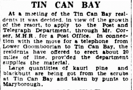
The town had also outgrown its Post Office and a new one was opened in July,1953 by the District Postal Inspector from Maryborough, Mr R. Holland. Mrs H. Brown one of the Gympie district’s oldest residents, handed the keys of the building to Mr. Holland, and later transacted the first business of the post office and posted the first letter. “The Post Office will provide a long-felt want for the resort”, it was reported.
In the last part of 1953 Tin Can Bay was struck by a cyclonic storm on Christmas Day, causing damage to homes and camper’s tents. Some houses were flattened. Trees were uprooted and holiday makers tents ripped and flooded. It was described as one of the worst storms in the settlement’s history. It was accompanied by 60 mile an hour winds and blew small watercraft ashore. Telephone communications were severed which made reaching the outside world difficult. Over 181 points of rain fell in 15 minutes. Water from the deluge entered most homes and unfortunately the new Post Office was flooded.
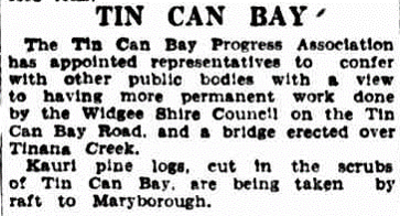
With all the growth in this area the beautifying of Tin Can was prioritised in the hopes of turning it into a resort town. The humpies and shacks which were built along certain areas of the Bay came under fire. The Tin Can Bay Progress Association asked Widgee Shire Council to introduce by- laws to prohibit shacks and other unsightly structures at Tin Can Bay.
The 1950’s saw the passing of a Tin Can Bay icon, Granny Brown. Mrs. Hannah Maria Brown, who was born in Norfolk, England. She was married at Newbiggin, County of Northumberland, on January 22, 1876, and came to Australia in a sailing ship, the Scottish Wizard, with her husband and infant son. They landed in Maryborough in January,1882, and went to Gympie to live. Later she bought a place at Tin Can Bay, and lived there for about 28 years, where she was known to all as “Granny.” She was the first one to live permanently at the bay.
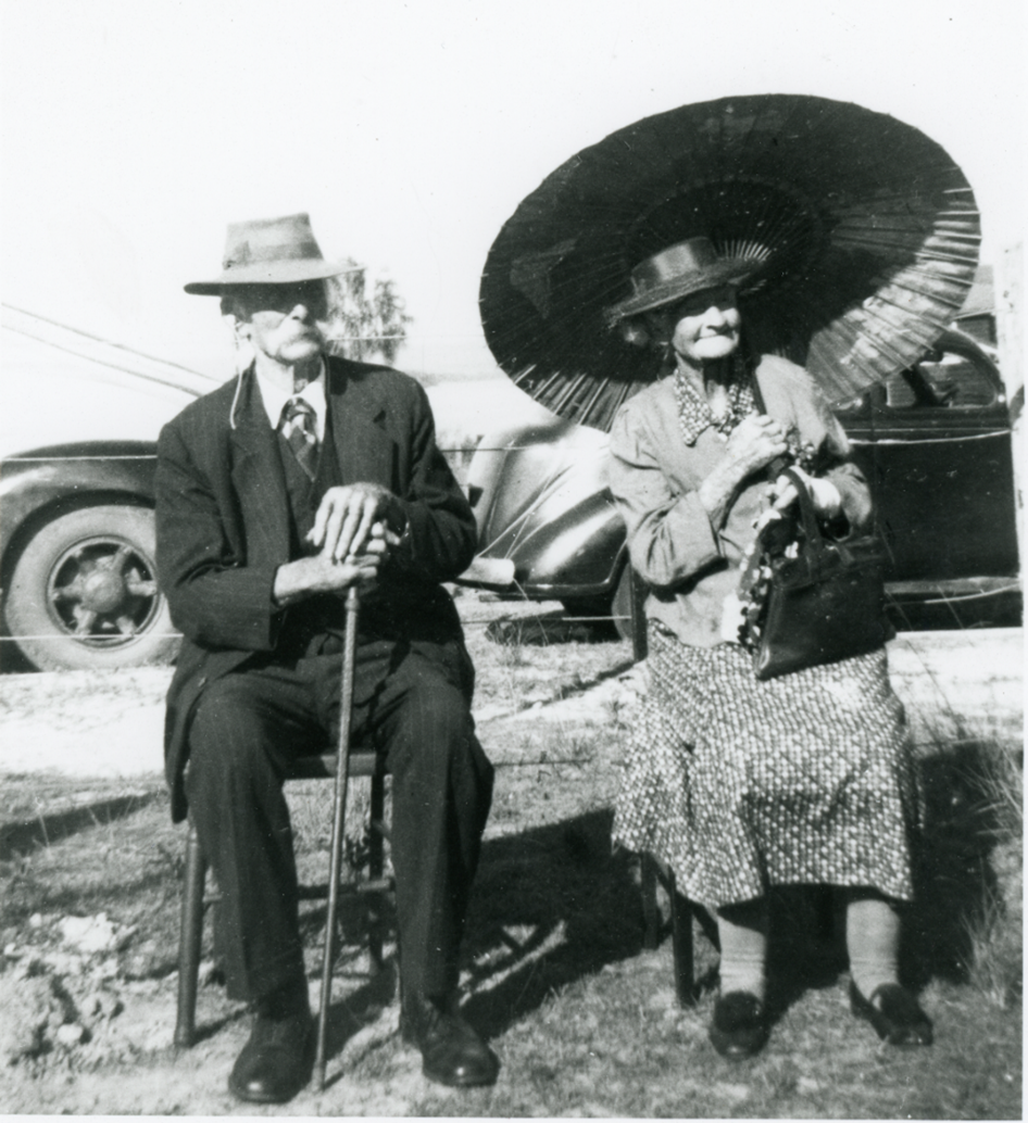
Her obituary notice states, “In June last year “Granny” and Mr. Jack Skyring, the two pioneers of the bay, led the Coronation procession. In July last “Granny” opened the “new Post Office and sent the first letter. She always had a small garden at the bay and did her own cooking and washing until she left four months ago, through ill health.
She was survived by 88 descendants — four sons, two daughters, 29 grandchildren, 49 great-grand-children and four great great-grandchildren.”
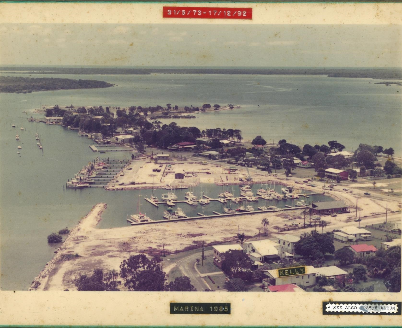
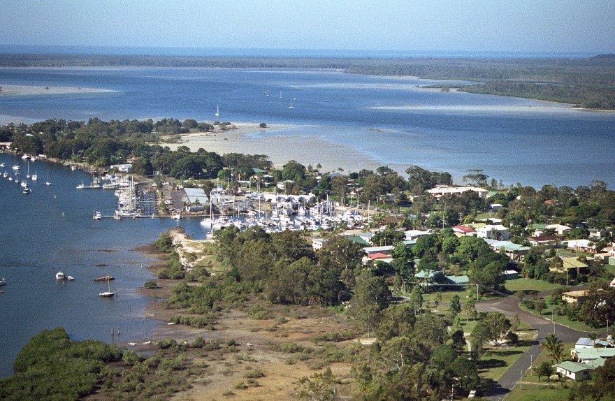
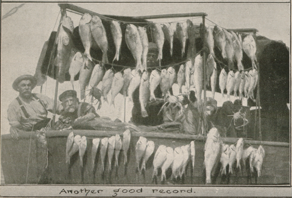
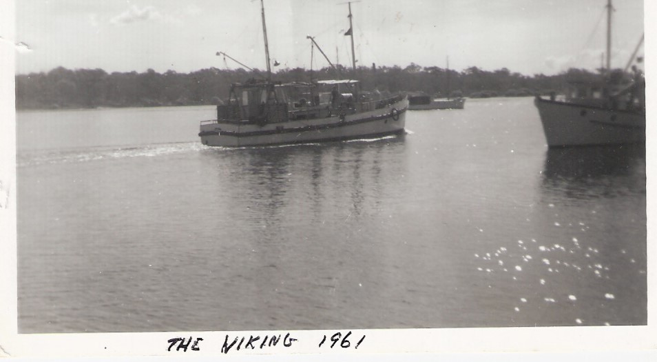
Tin Can Bay later became an important fishing port, with a focus on prawns as well as recreational fishing. In 1957 the discovery of banana prawns, by Fred Langford, in the Sandy Straits brought in a trawling industry. When news of the find broke out the first three boats on the scene were the Tamoi, Viking and Pathfinder. Within weeks over 75 boats had arrived at the bay to share in the spoils. From a sleepy lagoon, Tin Can Bay was suddenly a boom town. Every vacant weekend shack in the town was soon rented by the trawlermen and real estate values boomed.
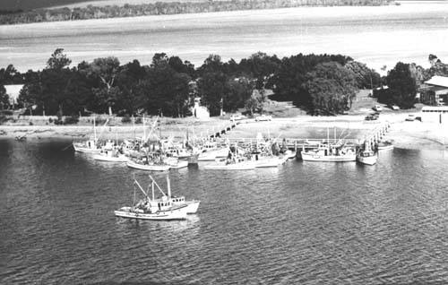

The giant tiger prawns, up to a foot in length, were worth up to two shillings each at the time and many trawlermen made quick fortunes. In just one fortnight of trouble-free operation one young trawler skipper was reported to have cleared more than 3,000 pounds. Tin Can Bay became a fishing port and ultimately the boating and fishing resort it is today. A sealed access road, a hotel and reticulated electricity followed in a few years. A new fish market was opened in 1971. A peak year for prawns was in 1964 when the Market put through 468,709 Ib. In the 1978-79 financial year the Market handled 410,338 kg of seafood. This comprised of 243, 092 kg of whole fish, 317 kg fillet, 104,620 kg of prawns and 62,309kg of other catches including Moreton Bay bugs, lobsters, squid, crayfish, sand crabs, oysters and 8,391 mud crabs.
Once a place where wives preferred to let their husbands go to on fishing trips alone became a popular boating and fishing resort for the whole family.
Officer Jonathan Norman Green has the honour of being the very first policeman to serve at the Tin Can Bay Police Station. Officer Green was sent as a temporary posting during the Easter of 1958. He then reapplied for the permanent posting in October of that year and arrived with his wife Alice to make Tin Can Bay their new home.
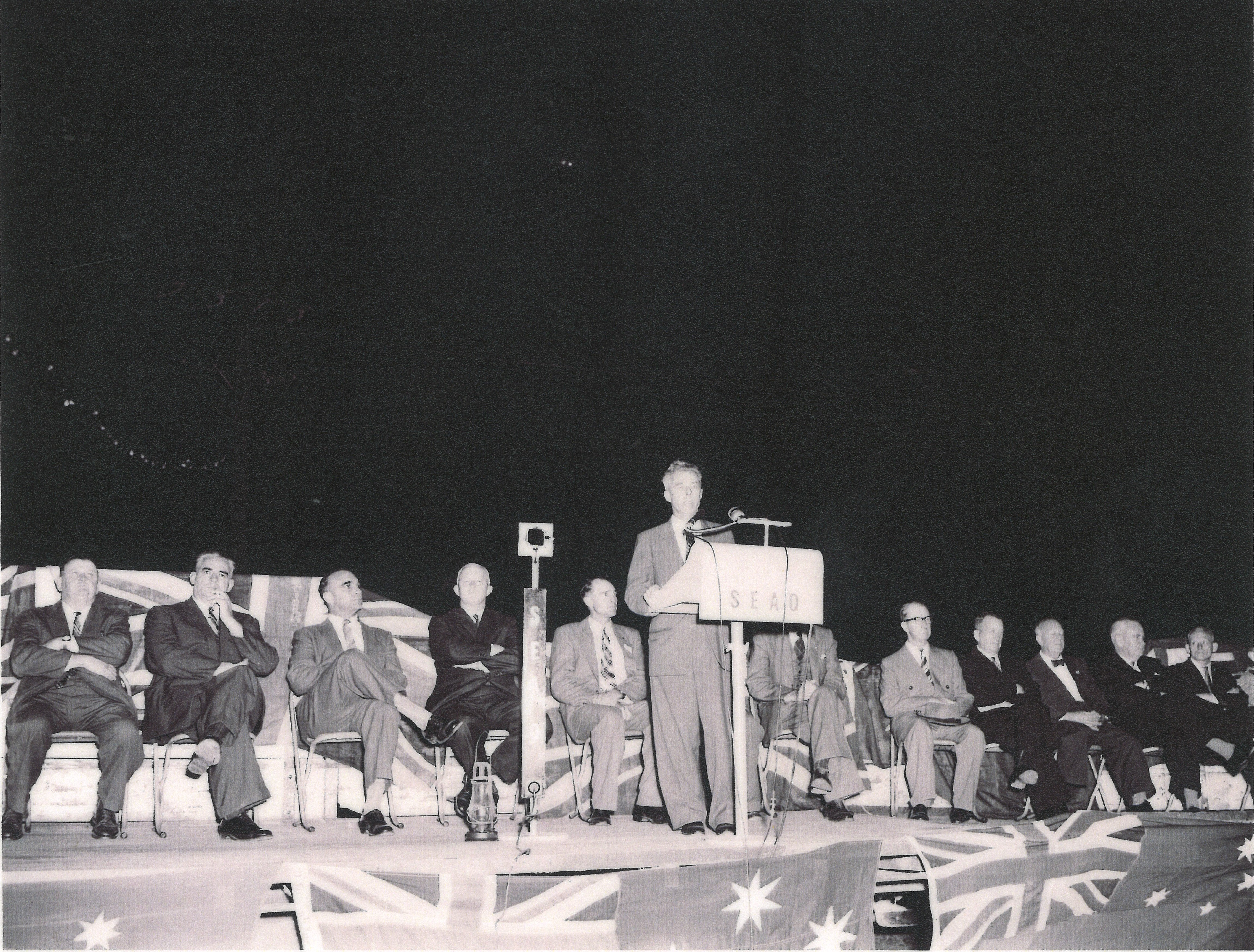
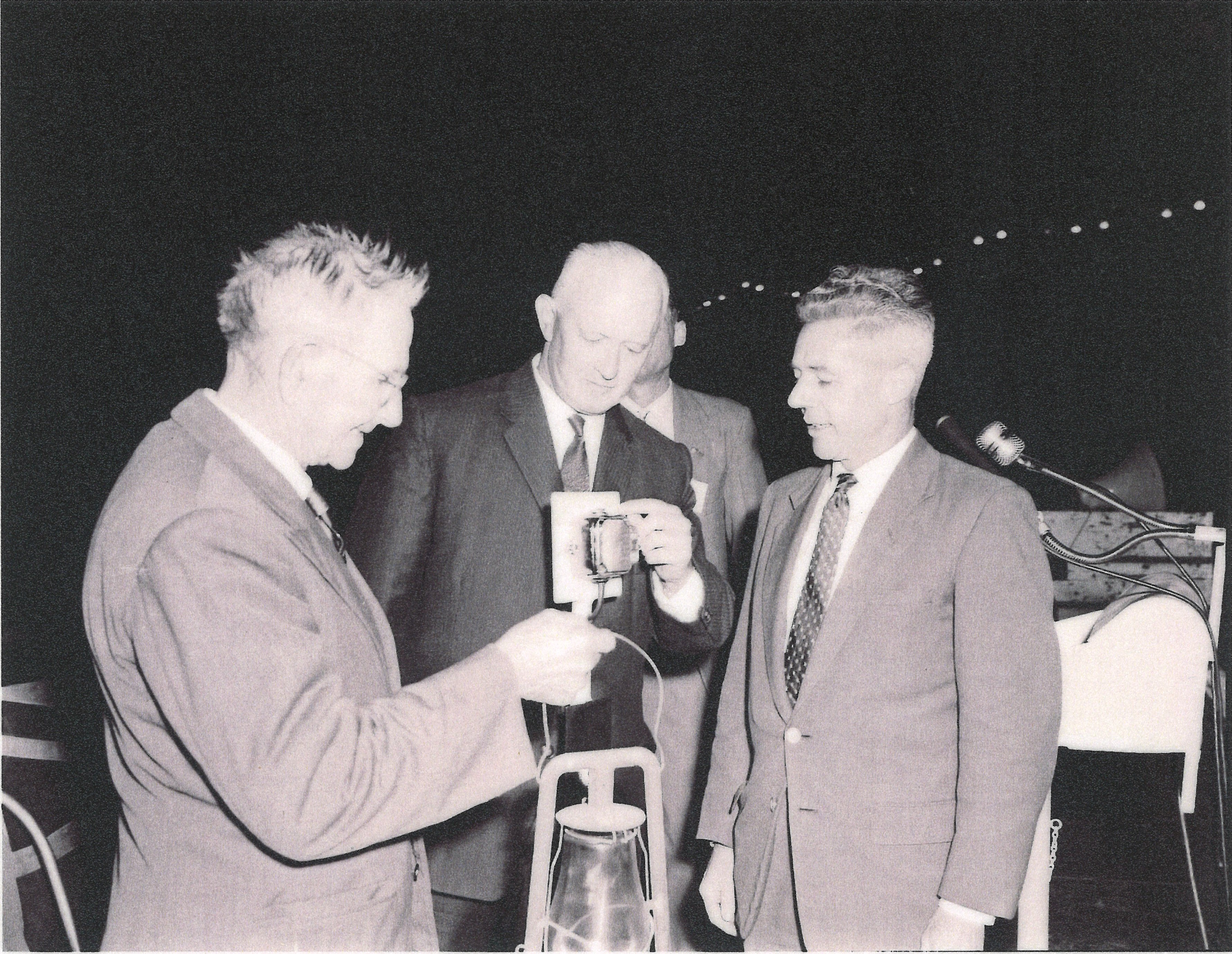
In the year of 1959 Tin Can Bay was upgraded from old Kerosene lamps to Electric Light. This event was honoured with a switching on ceremony which was planned to capture the attention of the audience. Before the dramatic moment when the State Treasurer Mr T. A Hiley threw the switch to make the street a blaze of coloured lights, he would extinguish a kerosene lamp, to symbolise the passing of the kerosene lamp era for Tin Can Bay.
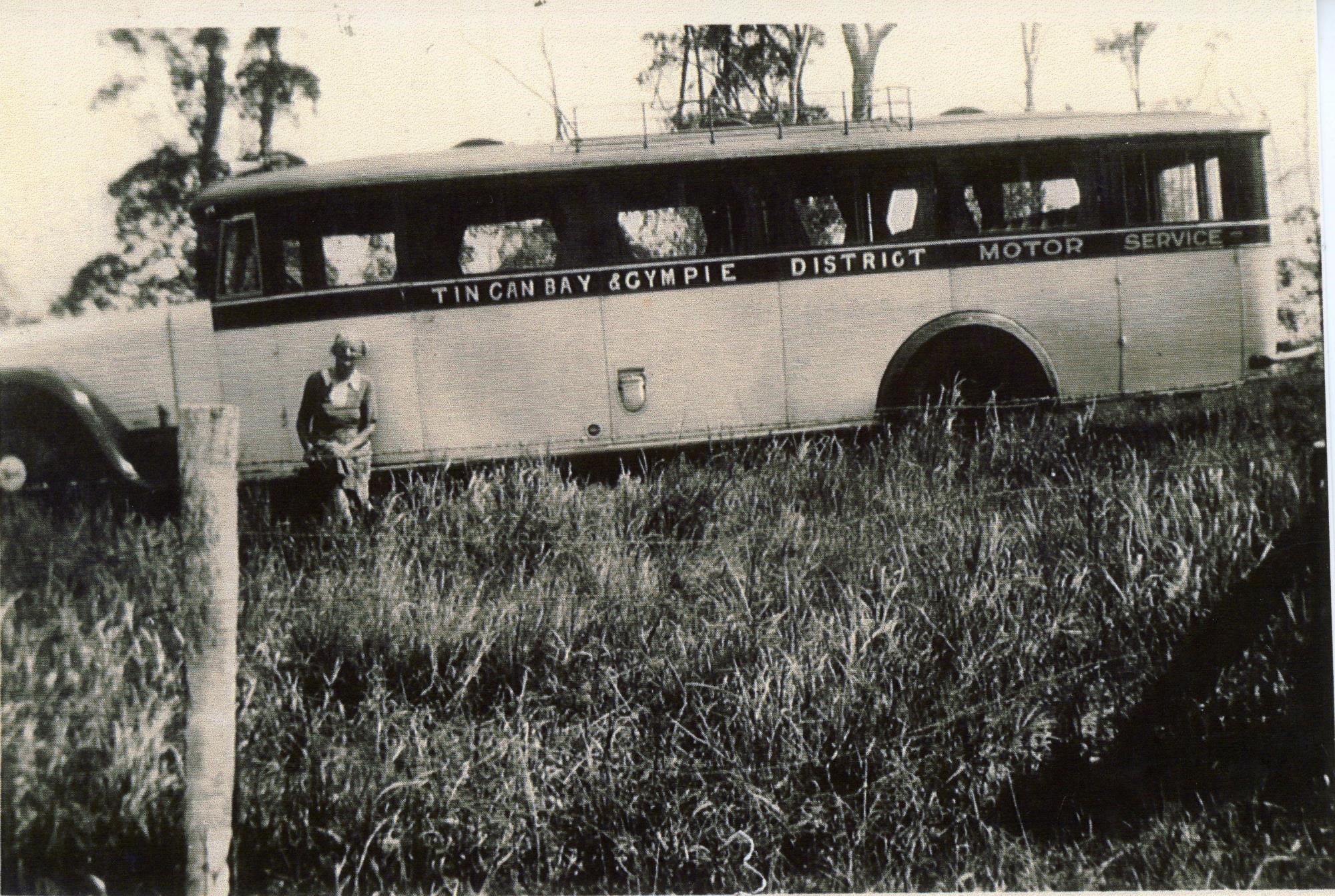
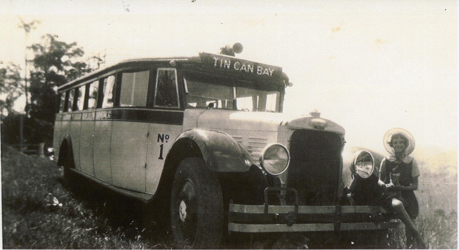
At the start of the 1950’s Queensland Titanium Minerals planned an extensive boring campaign to provide an area for the recovery of tin in Queensland. The directors reported that the mineral sands contain a substantial proportion of tin oxide. Scout-bores indicated an area containing 5,000,000 yards averaging better than 21 pounds of tin to the cubic yard. This would end up being a boon for the Tin Can Bay area. Queensland Titanium Mines’ sand-mining works were quite active during this time, employing some 80 men as of 1969— down from a one-time peak of 120 — extracting rutile, zircon and titanium from the mineral rich beaches surrounding the bay. The relative boom in prawning and mining over the last decade had given Tin Can Bay a sudden lease of prosperity. Most of the cottages in the township were new and modern, standing in ample plots of land which was still dirt cheap by the city prices in the late 60’s early 70’s. Supplies would come in daily to the general stores by bus or truck from Gympie.
The local branch of the Tin Can Bay Fire Brigade was established in the early 1970’s with Dino Anfuso being sworn in as the first Captain and Desley Goldsworthy was his lieutenant.
Tin Can Bay could naturally believe it had come of age and was now complete when the library was officially opened in 1980 with Joy Rigby as coordinator.
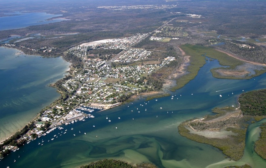
From then on Tin Can Bay has not held back continuing to grow and prosper. Many people and businesses have contributed to the wellbeing and development of the Tin Can Bay community by investing time, money and faith in its future. Residents are well catered for with a variety of fitness groups and sporting facilities. There are walkways and bike paths, craft groups, card playing clubs, indoor bowls and dance groups, cricket, tennis, football, golf and bowls, a skate park and swimming pool. In winter southerners flock to the caravan parks, motels and units to enjoy the warm temperatures and peaceful relaxed atmosphere. The great sandy strait is on the doorstep. In summer the beaches, playgrounds and picnic spots spill over with visitors and children wandering the sand flats, paddling in sting ray holes and chasing beautiful blue crabs which inhabit the sand flats in their hundreds.
Dolphins have become an icon of Tin Can Bay following interest from tourists and the broader community in the early 1990’s. They traditionally followed the boats into Schnapper Creek for many years.
As we have travelled down the timeline together, we find that through a period embracing many changes socially, locally and globally Tin Can Bay has gone from strength to strength. Many exciting things have occurred in the past to influence and shape our feelings to inspire this community to face a bright future together.
This of course would not have been possible without the early pioneers of Tin Can Bay. Such names as Jim and George Elliot, Pat Dam, Stan and Colin Holloway, Jackie Power, Bob Hose, Fred Dodt and Fred Gilmore, Gus Austin, Tom Steele, Bon Naylor, Granny and Henry Brown, Gordon Jones, Mac Skyring, Arthur Schumann, Mal Buchanan, Viv Mason, Sam Bacon and many others.